- Starting point: Orvieto
- Distance: ca 49 km
- Maximum altitude: 580 mt
- Interesting sights: Torre Alfina Castello, Mausoleo Cahen
- Destination: Orvieto
A challenging mountain biking course starting from Orvieto. Go towards Gabelletta-Tamburino and climb the hairpin turns of the Buonviaggio road (direction Viterbo-Bolsena), after a series of switchbacks uphill from which you can appreciate a beautiful view of the cliff of Orvieto, you arrive in Villanova, turn right towards San Lorenzo Nuovo-Castel Giorgio.
From here continue for long stretches of flat through the small village of Casa Perazza until you reach the junction that leads to the center of Castel Giorgio. The town is over 550 meters high..
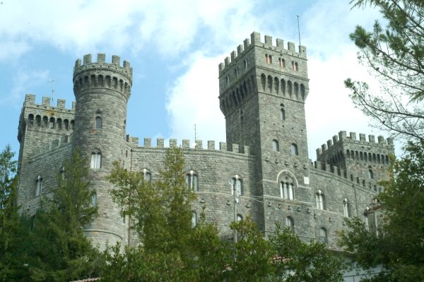
Pass through the center of Castel Giorgio and continue on Via Cupa and then along the provincial road 45 towards Acquapendente-Castel Viscardo. Here along a straight road in the territory known as Piana dell’Alfina. Near the small airfield and airport of Alfina turn left along the main road 47 towards Torre Alfina, a small pretty village of Lazio dominated by an impressive medievale castle. Along this quiet countryside location continue straight to the next junction to get to the the center of the village. From here you get to the central square where on the right you can see the beautiful castle with crenelated towers. Continue for a few meters and take a small road on the right (referred to as the Le Coste).
From here you start the descent with twists and turns, in a beautiful green and wooded area and in this area you can also visit the Bosco Sasseto a natural area where there is also the Gothic mausoleum housing the remains Marquis E. Cahen the owner of the castle of Torre Alfina and the Villa La Selva (or Villa Cahen), in the town of Allerona. From here it also begins the well-beaten gravel road becoming more tortuous, until the Paglia river, which acts as a natural border between Umbria and Lazio. At this point the “bridge Cahen” connected this part but now it’s not accesible so that you have to cross the Paglia river in the lowest level of the water and then take a wild path that tends to rise through the lower part of the large forested area of Selva di Meana, just below Villa Cahen. Take an easier road that leads to the village of Allerona Scalo, going from a forest environment to an open area with vineyards and farmland. From here it is shooting, near the local soccer field the paved road that passes through the town and then right onto the provincial road 48 towards Orvieto.


