- Interests: landscape, nature and culture.
- Route time: 4-5 hours without stops
- Difficulty level: A hiking path of medium difficulty, requires some training for the length and elevations.
- Elevations: 200 meters up and about 400 meters down
- Characteristics: dirt roads and paths, scenic stretches, pasture and forest
This is a trip not too demanding and certainly very scenic. The route runs along the ridge from the top of Melezzole Monti Cross and Serra (994 m) drops to Melezzole. The starting point is the small village of Melezzole (TR), the classic medieval round castle, situated on a hilltop (612 m s.l.m.) and implanted on three concentric circles that have centered around the central square.
From Melezzole take the road towards Montecchio. The road is paved up to the cemetery then it becomes a dirt road. At a small reservoir for rain water on the right, leave the main road with a sharp turn to the left, taking the dirt road that runs through the chestnut forest of Melezzole. Continue on the cart track that is quite bumpy and accessible only by jeep or on foot.
You get up to a kiosk with a statue of the Madonna and tables picnic (820 m asl). From here begins the real journey on foot, continuing on the cart track closed shortly after by a bar and a gate on the side that allows the passage.
The dirt road continues climbing and turns left, towards the top of Mount Melezzole, also called Mount Pelato. Evident on the top there are antennas and large towers. Continue along the ridge down to the pass that separates Monte Melezzole and Monte Croce di Serra.
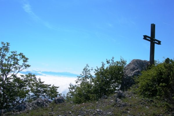
The route then returns in the woods but remains clear if you pay attention to red path markers, and continue keeping to the west side, then turn left (east) to reach the summit cross (994 m.) Monte Croce di Serra.
The twin peaks of the mountains Melezzole and Croce di Serra open to breathtaking views, with a very broad view both towards the Tyrrhenian (Monti Cimini hills of Tuscia, Monte Amiata), and towards the central Apennines (the Sibillini Mountains and Mt. Terminillo), the valley of Terni and the Umbria Valley (Mount Subasio and the curtain of the Tuscan-Umbria-Marche to the north). You can see all the small villages below, Corbara lake and the oasis of Alviano in all its extension. Besides the landscape is also relevant aspect of the vegetation of the area. Running through pastures pretty sparse but also sometimes very interesting woods: the remarkable Castagneta and deciduous forests with oaks, hornbeam and flowering ash, and descending along the ridge, the holm oak mixed with strawberry trees, heather and juniper it manifests in abundance in the Mediterranean.
From the top of Monte Croce di Serra you can go down to the south, along the pastures of Posi and towards the last peaks of the chain, overhanging the town of Santa Restituta (581m).
Go through a wooded area and then a dirt road up to the small village of Santa Restituta where you can return to the starting point or from Posi take a track which reports directly to Melezzole.


