- Average travel tme: 4 and a half hours without stops
- Distance: 20 kms approx
- Difficulty level: A hiking path of medium difficulty, requires some training for the length and elevations.
- Elevations: 320 meters up and 220 meters down
- Route markers: white/red number “4F”markers and signs of the trail.
- Characteristics: dirt and farm roads, forest trails.
- Interests: landscape, nature and culture.
An itinerary that has as its starting point the city of Orvieto, close to Porta Maggiore (260 m) and Foro Boario. From here begins the red and white trail signs that suggest the beginning of the route. Once you take a smaller paved road that leads downhill in the direction of Rio Chiaro and Ponte del Sole bridge (184 m). Briefly passing the busy road Umbro-casentinese, over the bridge go up in a straight line along the steep cobbled road Via del Tamburino..
On the right is the Orvieto cemetery, continue up to a junction at 334 m. At this point leave the paved road briefly reaching a bend of the road (SR71), which follows coming to the Trinità and to a building with a tower until reaching an abandoned restaurant.
From here turn right into a dirt road and down towards Sugano: you are close to the Sasso Tagliato and already from here you can enjoy a superb view of Orvieto.
Continuing through the shady woods of Macchia dei Frati and passing the Pontesasso ditch, you arrive at the foot of Sugano (410m): This is a small fourteenth century fortified village where traces can be traced back to the fourth century B.C. when in the countryside surrounding the rock of Orvieto was settled by the Etruscans. The vertical wall on which stands the village of Sugano is characterized by the presence of numerous springs, one of which feeds the series of pools which are one of the oldest public washrooms, placed at the base of the basalt cliff.
Leave the washhouse and follow the paved road that climbs up to the village center, it is around the village, past the turning for Fraschetta and you come to the Tione Source (380 m): it is a source of water with low mineral content which derives directly from the powerful layer of volcanic rocks that lie at the foot of the village of Sugano.
The sources which have always been appreciated for the quality and purity of water in the past fed a brick furnace, two mills for grain and one for the oil and subsequently were also used for breeding otters. Today the old mill remaines in ruin overgrown with two rusting turbines, while the sources are used for industrial bottling since 1991.
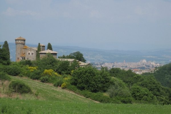
From the sources go along a dirt road rises overlooking the village and you will arrive at San Quirico Castle (435 m), dating from the thirteenth century and renovated in 800. The Castle is now privately owned and can only be admired from the outside.
At this point you reach the edge of the plateau, the landscape changes and becomes more open, with cultivated fields, pastures, monumental oaks, farmhouses and small stretches of woodland.
Leave this ancient parish and take an ancient dirt road that leads through the woods and then up to Monte Tigno.
This area offer a wonderful view of Orvieto with its cliff at the center and to the left Ripesena Rocca that especially at sunset, are colored in a beautiful red.
After a big turn to the right continue along the forest trail which is characterized by the presence of oaks, chestnut trees, holly and loquats.
This path touches down at the Sossogna farm (380m) and La Rocca farm brings us to the road to fall back towards Ripesena Rocca (368 m), a small town that looks like a miniature Orvieto. It is situated in a panoramic position and rests on a volcanic rock that is believed to have the same origin as the cliff of Orvieto.
From Rocca Ripesena there is a chance to return to Orvieto using public transportation or go downhill on the asphalt road that goes to Sferracavallo and then back to Orvieto center.


