- Starting point: Orvieto
- Distance: approx. 35 km
- Maximum altitude: Località La Sala-Bagni 445 mt
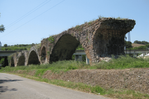
- Interesting sights: Ponte Giulio, Castello della Sala
- Destination: Orvieto scalo
An enjoyable itinerary that goes over the new bridge of the Paglia river. Starting from Orvieto center head down for Piagge (very steep unpaved) you reach Orvieto Scalo on Via Sette Martiri, from here go right towards Allerona along the road of Patarina, after a few hundred meters you take the gravel road on the right going down. The road has no indications and is immediately after a straight portion in the vicinity of an area with housing on both sides.
The small road down, follow it until you reach the dirt road that runs alongside the Paglia river. Continue straight on this road to the end and you have to take left onto another path back on the paved road near the ruins of the Ponte Giulio. From here turn right along the flat paved road and continue straight up to Le Prese, from there right towards Allerona-Pianlungo.
To the village the road is paved and flat. Once in Pianlungo turn right (sp 48), after the railway underpass and continue always on the provincial highway. From here the landscape is expanding and is filled with hills covered with vineyards and the slope gradually increases.
After a few kilometers the road passes just below the majestic Castello della Sala and then continue again, from this point until reunification with the main road (SR 71) the slope is steeper. When you reach the entrance with this main regional road turn right and begin a long descent with bends passing through the small village of Bagni.
The descent ends near the plains of Pian del Vantaggio, an area characterized by farms and crops. From here a short climb and then again downhill to the residential area of La Svolta, which is straight until the stadium where the road turns right and over the new bridge before crossing the Chiani river that leads directly to the area below the train station near the Piazzale della Pace parking lot.


